The Dukla Municipality
The coat of arms of Dukla is on the white background and shows three black hunting horns, which are arranged in a way that resemble a windmill. The fittings of the horns and their stripes are gold. The coat of arms originates from the Trumpets coat of arms, which was used by the founders of the town, the Jordan family. The same theme, used since the 16th century, can be found on the seals of the Dukla town.
Statistical Data
Demography of the Dukla Municipality (December 2016 status):
Number of residents: 14 727
Women: 7498
Men: 7 228
Growth rate: 0,75 ‰
Demography of the Dukla Municipality (according to the localities):
| No. | Locality | No. of resident | No. of births | No. of deaths |
Growth rate |
| 1 | Barwinek | 271 | 1 | 0 | 1 |
| 2 | Cergowa | 1349 | 11 | 8 | 3 |
| 3 | Chyrowa | 102 | 0 | 1 | -1 |
| 4 | Dukla | 2129 | 25 | 22 | 3 |
| 5 | Głojsce | 795 | 8 | 7 | 1 |
| 6 | Iwla | 743 | 8 | 9 | -1 |
| 7 | Jasionka | 1197 | 9 | 16 | -7 |
| 8 | Lipowica | 269 | 3 | 3 | 0 |
| 9 | Łęki Dukielskie | 1646 | 13 | 24 | -11 |
| 10 | Mszana | 277 | 2 | 2 | 0 |
| 11 | Nadole | 518 | 7 | 4 | 3 |
| 12 | Nowa Wieś | 171 | 2 | 2 | 0 |
| 13 | Olchowiec | 57 | 0 | 1 | -1 |
| 14 | Ropianka | 10 | 0 | 0 | 0 |
| 15 | Równe | 1911 | 13 | 16 | -3 |
| 16 | Teodorówka | 1078 | 14 | 11 | 3 |
| 17 | Trzciana | 221 | 2 | 3 | -1 |
| 18 | Tylawa | 396 | 3 | 2 | 1 |
| 19 | Wietrzno | 841 | 4 | 13 | -9 |
| 20 | Zawadka Rymanowska | 242 | 4 | 3 | 1 |
| 21 | Zboiska | 425 | 5 | 5 | 0 |
| 22 | Zyndranowa | 127 | 1 | 1 | 0 |
| Total | 14 775 | 135 | 153 | -18 |
Area: 235,14 km²
The population density: 63/km²
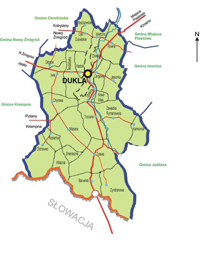
The Dukla Municipality consists of 1 town and 21 villages.